Planning & Permits
Note: On February 16, 2024, a new Minister’s regulation (Ontario Regulation 41/24: Prohibited Activities, Exemptions and Permits) under the Conservation Authorities Act was approved by the Province. This regulation will replace the existing individual “Development, Interference with Wetlands and Alterations to Shorelines and Watercourses” Ontario Regulation 179/06 held by the Lake Simcoe Region Conservation Authority and moving forward, O. Reg. 41/24 will be used by all Authorities. The regulation’s effective date is April 1, 2024. The enactment of O. Reg. 41/24 will also coincide with the proclamation of associated sections within the Conservation Authorities Act.
The Conservation Authority will continue to require applications for a permit to undertake otherwise prohibited development, interference and alteration activities in regulated areas as defined under the Conservation Authorities Act and in O. Reg. 41/24.
Planning, Permits & Regulations
All regions of Ontario experience flooding, erosion and slope failures. These are naturally occurring processes that have been continuously shaping and reshaping the earth for thousands of years. These processes represent a “hazard” when people and structures are located within areas directly impacted by these naturally occurring processes.
The Lake Simcoe Region Conservation Authority (LSRCA) administers regulation 41/24 made under Section 28 of the Conservation Authorities Act.
This regulation allows Conservation Authority to ensure that proposed developments have regard for natural features in order to:
- prevent loss of life;
- minimize property damage and social disruptions;
- reduce public and private expenditures related to emergency operations, evacuations and restoration;
- minimize the hazards associated with development in floodplains and areas which are susceptible to erosion, which in future years may require expensive protective measures.
Our work in regulating lands has several major components.
How We Do It

Regulation Permits
We ensure that development proposals have regard for natural hazard features and the natural environment, while conforming with our watershed development policies in accordance with the Conservation Authorities Act Ontario Regulation 41/24 and the Lake Simcoe Protection Act and Plan.

Plan Input and Review
We are responsible for representing the provincial interests with respect to natural hazards (examples include flooding, erosion and unstable ground) and natural features on applications circulated under the Planning Act. We are responsible for providing advice on the interpretation of the Provincial Policy Statement. We also have agreements with the Region of York, Durham, the City of Kawartha Lakes, and the County of Simcoe to provide comments on natural heritage features, which include significant woodlands, wetlands, environmentally sensitive areas, fish habitat, as well as rare, threatened and endangered species and their habitats.

Technical Assistance
Our engineering staff are available to regional and local municipalities within the watershed. Complementing our planning staff, they comment on the water management and natural hazard aspects of all planning applications. Our engineers clear conditions of approvals and issue permits where required. They are involved in preparing watershed plans, remedial strategies and stormwater management strategies and the design of capital work projects and major floodplain engineering studies. Our engineers design these projects, prepare tenders, and supervise the implementation and construction activities as required. Key areas of expertise include: hydraulics and hydrology, planning input and review, regulations, data collection and computer modelling, remediation and restoration techniques, project design, tendering and supervision.

Regulation Implementation Policies / Guidelines
Recognizing that urbanization occurs within some limits and is ultimately limited by the capacity of the natural environment, our goal is to foster and consistently apply watershed development guidelines which protect the environmental integrity of our watershed.

Landowner Assistance
Our funding program provides technical and financial support to private landowners in completing environmental projects designed to improve water quality and soil conservation, and enhance natural areas.

Flood Forecasting and Flood Control
We are responsible for issuing flood warnings to help reduce flood damages. We do this by: monitoring weather conditions and river flows issuing flood messages (advisories and warnings) to a variety of public service agencies through the media and this website controlling development in flood-prone areas to reduce potential property damages.
Guidelines
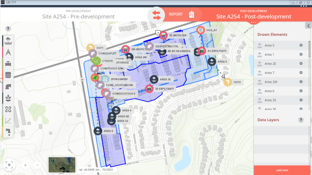
Low Impact Development Treatment Train Tool
Office Hours
Our new public office hours will be Tuesdays, Wednesdays and Thursdays from 8:30 am to 4:30 pm.
We highly recommend making an appointment in advance to ensure there is staff available to help you.
![]() Who to Contact
Who to Contact
Permits & Regulations
✆ 905-895-1281
✆ 1-800-465-0437 Toll free
✉ regulations@lsrca.on.ca
Submit electronic applications to
✉ applications@LSRCA.on.ca

