What is a Watershed
Water and the Watershed
A sprinkle, a pitter-patter, a gentle shower, a battering storm or the trickling melt of snow – this is the story of water’s journey to the heart of our watershed: Lake Simcoe.
We think it’s important to understand two things – first, what a watershed is, and second, how water travels through our watershed. We know that when we understand this journey, we can make better decisions to protect how our environment functions.
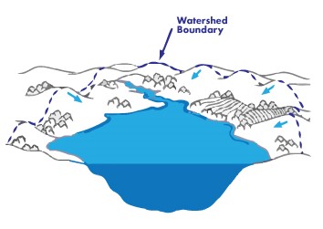
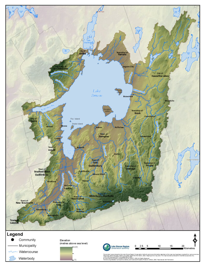
A watershed is created by natural elevations and landforms. In the case of the Lake Simcoe watershed (see the map on the right), the Oak Ridges Moraine to the south and the Oro Moraine to the north are significant natural land features that delineate our watershed – creating a shape similar to a bowl. When it does rain and the snow melts, the water flows from all of those high points down to the lowest point – Lake Simcoe. No matter whether it’s raining over Newmarket, Barrie, Uxbridge, or Schomberg, it all eventually makes its way to Lake Simcoe.
Before our watershed became urbanized, water was easily absorbed into the natural, undeveloped landscape. The challenge water now faces on its journey to the lake includes human obstructions, like roads, houses, and parking lots. Paved or impervious surfaces (fancy way of saying surfaces that water can’t penetrate), dramatically change the way water interacts with the land and the way it flows.
Rain may fall on a lawn, soak into the ground and eventually make its way underground, into a local stream and then to Lake Simcoe. It also falls on roofs, driveways, parking lots and roads, where it will enter the local storm sewer system and eventually be released into a nearby river or stream that also flows into Lake Simcoe.

At LSRCA we strive to manage these changes on our land in order to protect the quality of our water and to help maintain its natural flow towards Lake Simcoe. Our planning staff, engineers, flood forecasters, scientists and restoration specialists see to that. It’s why you sometimes need to get a permit from us. It’s also why we review development plans on behalf of municipalities, so that the changes we do make on the land have as little impact as possible on water’s natural flow. It’s why we fund restoration projects like tree planting and the creation of wetlands. The more natural the flow, the less risk to us and our properties, and the better our environment functions.
Topography determines a watershed boundary because water flows from high ground to low ground. A watershed is an area of land that collects and drains rainfall and snowmelt into a body of water.
What’s your role in this journey? It’s to consider that no matter where you are in the watershed, the water that falls and flows through your neighbourhood and town or city, all flows into Lake Simcoe.
You can help or hinder how those water drops reach the heart of Lake Simcoe. You can’t help the water without looking at what we’re doing on the land. Naturalizing your landscape, supporting Low Impact Development, learning and teaching about how our land and water are linked. Every bit helps.
![]() Who to Contact
Who to Contact
Customer Service
✆ 905-895-1281
✆ 1-800-465-0437 Toll free
✉ info@LSRCA.on.ca
![]() Lake Simcoe Living
Lake Simcoe Living
This newsletter was originally published in the Summer 2020 issue of Lake Simcoe Living.

